MAP OF MILITARY INFLUENCE - MAY 2016
Map of Military Influence for May 2016
After precise checkup of information and data related to the distribution of military forces in the Syrian desert, Jusoor for Studies center has released the Map of Military Influence of May which includes the area of influence and distribution of the New Syrian Army in the Syrian desert, precisely in the Tanaf Border crossing, thus the Map of Military Influence this month has accomplished an important element of the actual military forces.
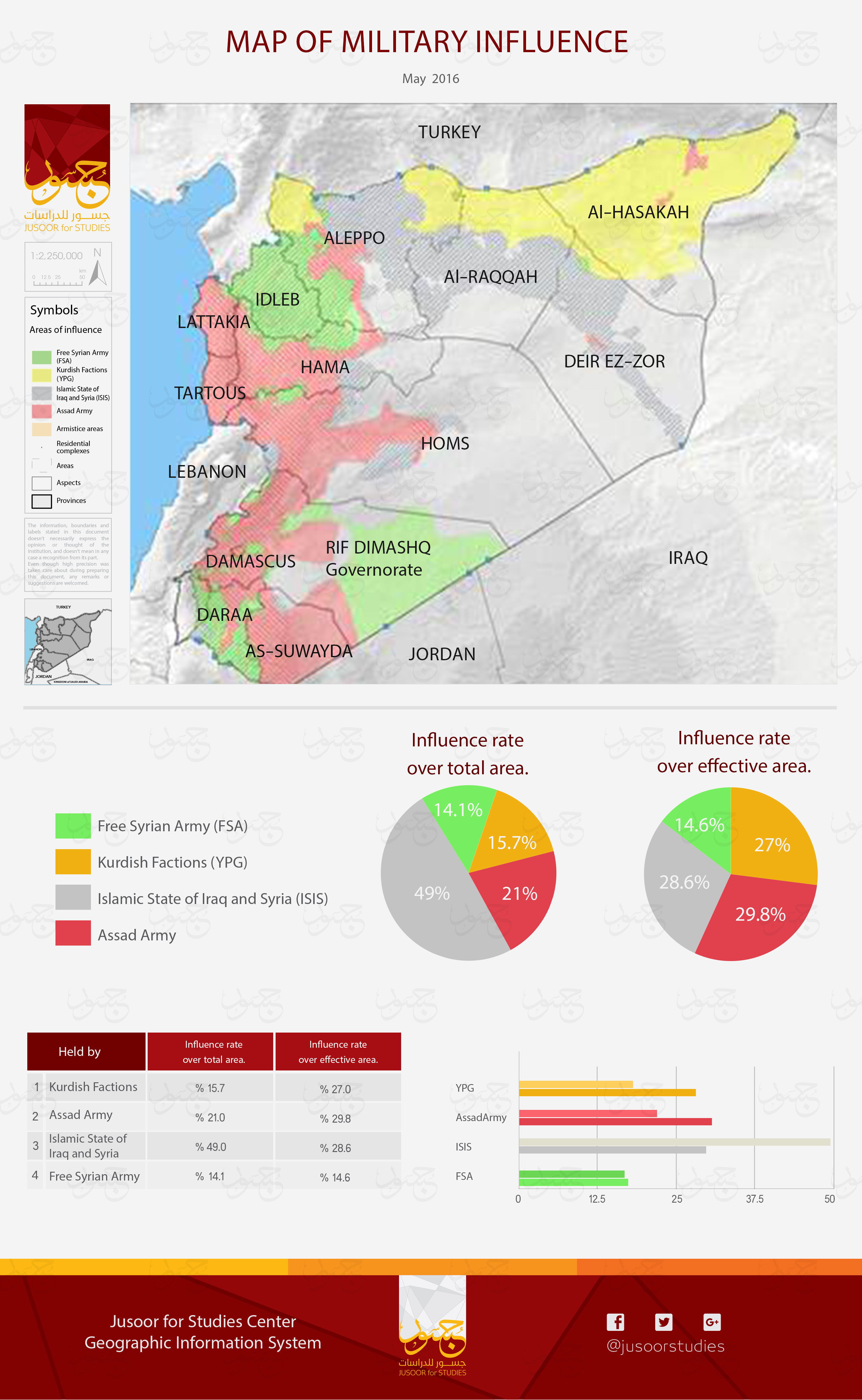
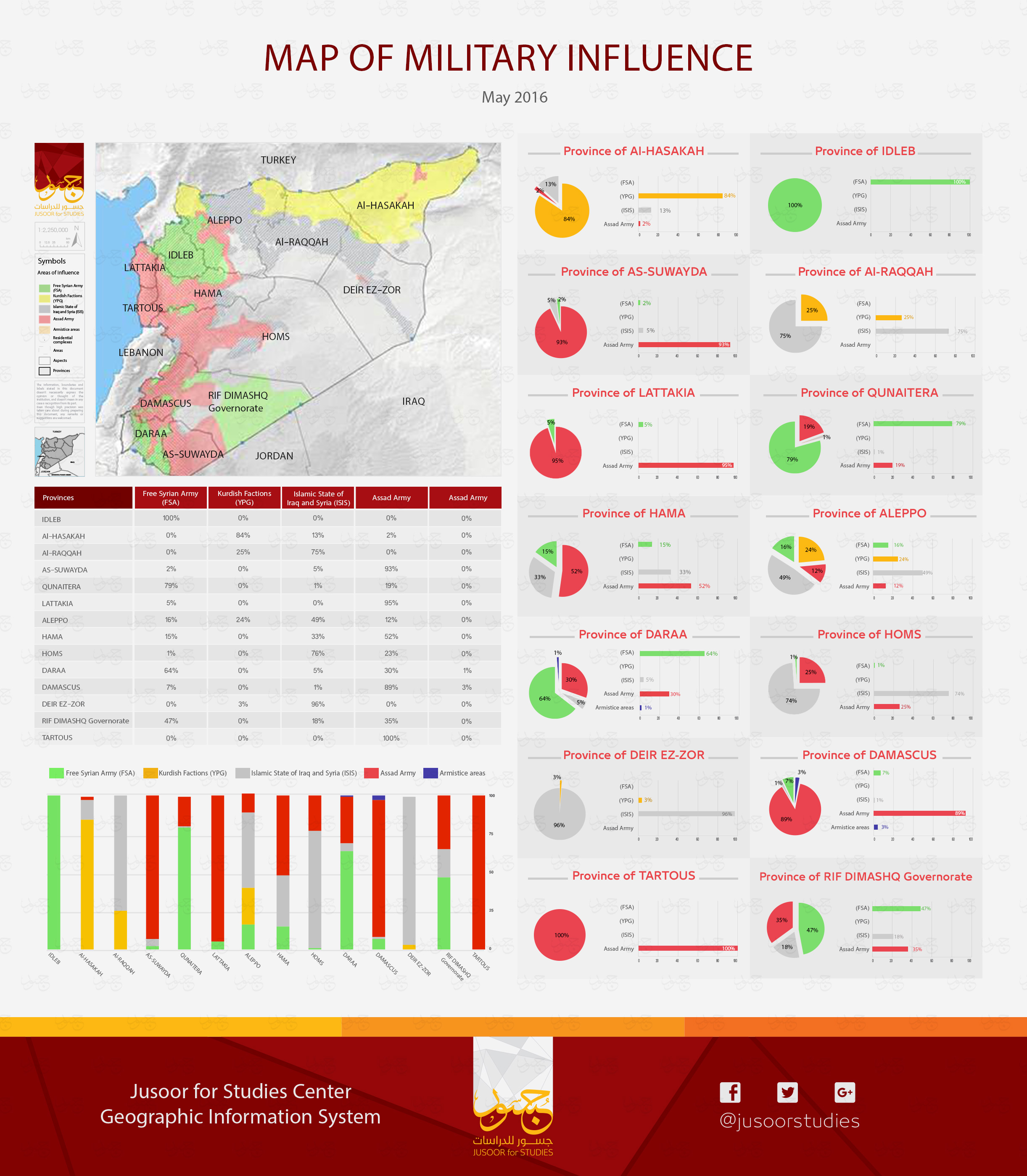
The GIS unit in JUSOOR for STUDIES Center release a Map of Military Influence in SYRIA monthly, in which the ratio of Military Force existing over the SYRIAN territories is specified, these military forces are: Free Syrian Army (FSA), Assad Army, Islamic State of Iraq and Syria (ISIS) and Kurdish Factions (YPG). The MAP specifies the presence of the former forces over the total area of Syrian territories (Influence rate over total area) and also the area of influence over the effective areas (Influence rate over effective area); which is defined by the distribution of communities (City, Town, village( and additionally important locations as airports, seaports and Important border crossings. The Center aims by releasing this map monthly to follow up the military advances in Syria by studying the actual situation of the forces and its factions in the Syrian territories, and present this advances that happen to help the local influencers know what really happens in the field so they can develop an overall perspective. The map is published in two sections, the first represent the influence area over Syria in general, while the second goes specifically to every province.