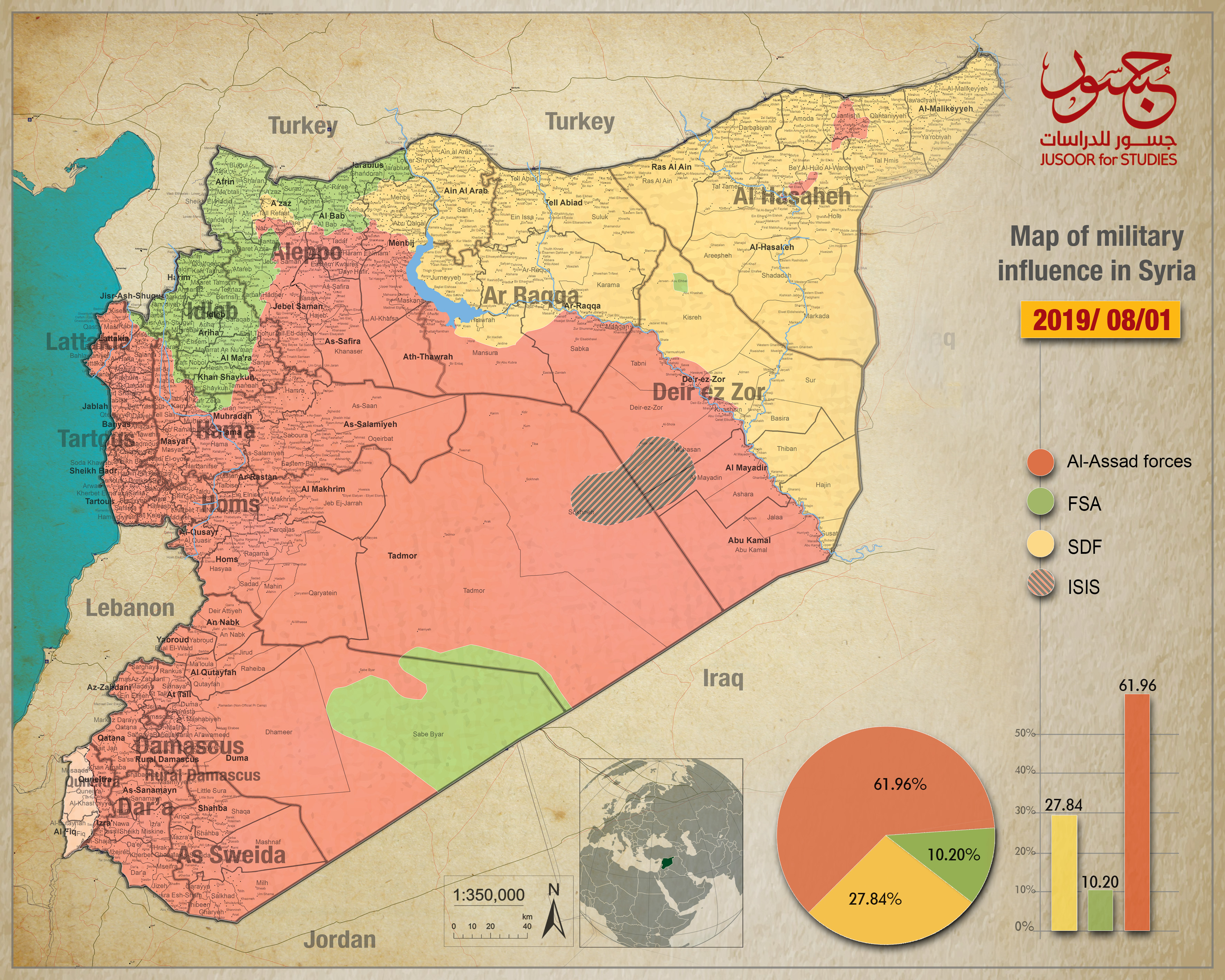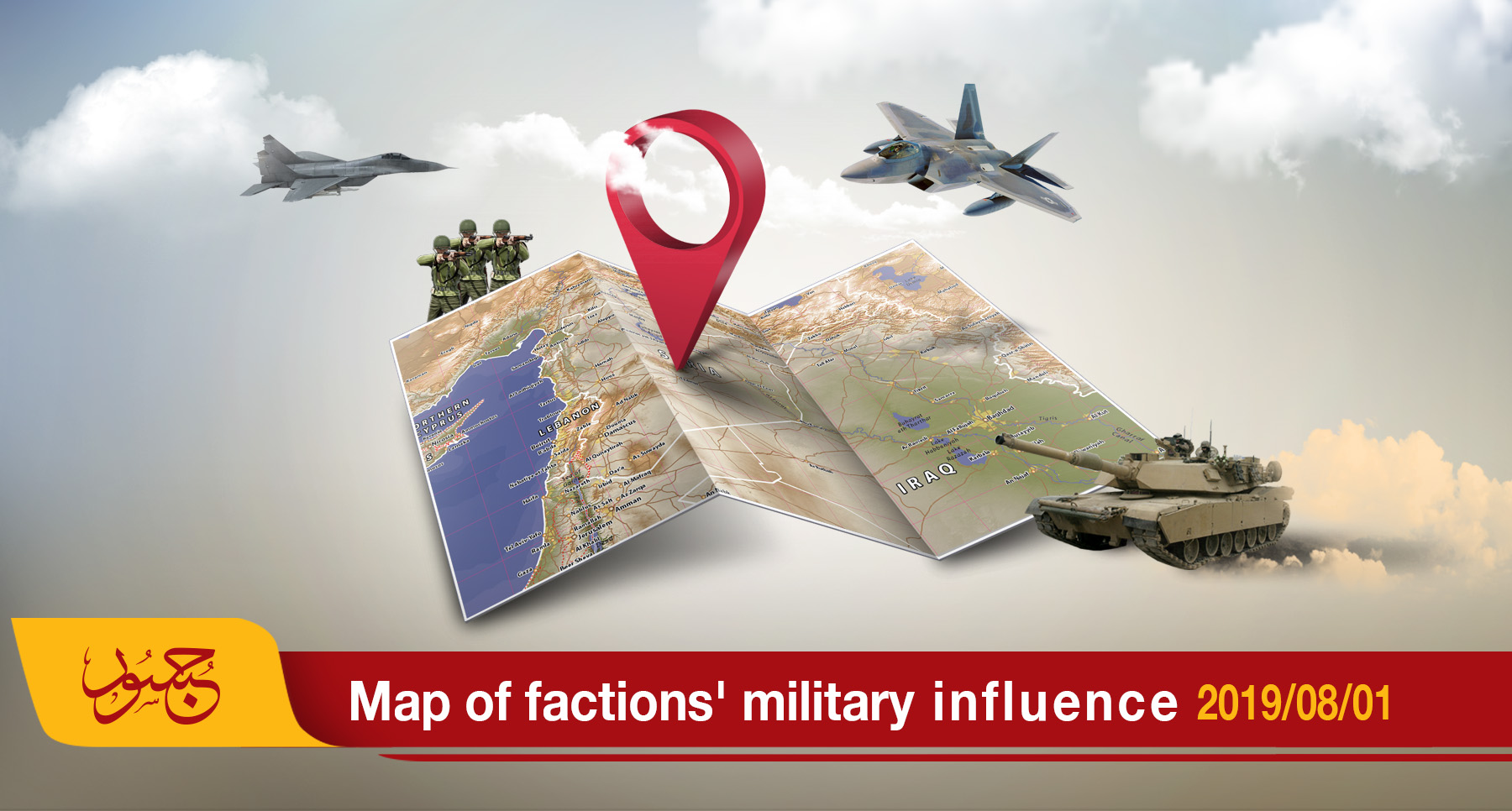
Map of military influence in Syria 01-08-2019
The map of military influence in Syria for July 2019 shows a slight difference in the total percentages of control among the various conflicting forces on Syrian territory compared to the ratios recorded in June 2019.
According Jusoor Center for Studies’ monthly map, the land under Syrian regime control has reached (61.96%) compared with the (61.92%) recorded in June. While the percentage of land under opposition faction control fell to (10.20%) compared with the 10.24% recorded last month.
The Syrian Democratic Forces (SDF) have maintained the percentage of land under their control at (27.84%) since May 2019. The Islamic State in Iraq and Syria (ISIS) no longer controls any Syrian territory since February 2019.
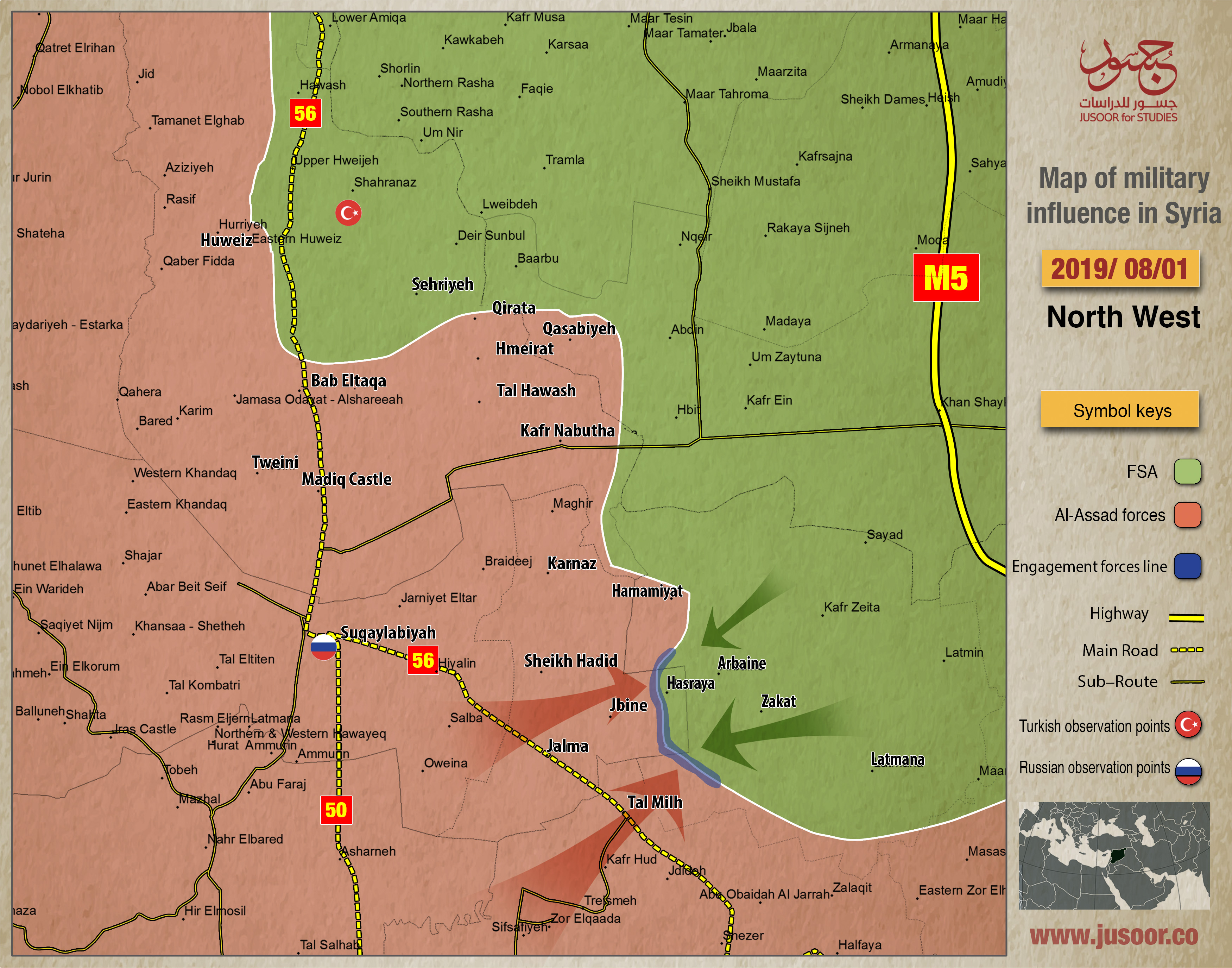
The Syrian North
The map of military influence and control in northern Syria has undergone adjustments due to the Syrian regime’s ongoing military campaign against the area which started on May 6, 2019.
On June 28, 2019, the Syrian regime launched a ground offensive in which it regained control of the strategic al-Jabain village and hill, two sites that it had lost to the armed opposition factions on June 6, 2019. At that time, the opposition factions had also managed to gain control of the villages of Hasraya and Kfarhopd and part of al-Jalamah before withdrawing from the last two after suffering heavy bombardment. On July 29, the regime forces resumed their advance and took control of Hasmina Valley. On July 30, it also took control of the Abu Reida Western Farms area.
Accordingly, the area controlled by the Syrian regime since the beginning of the military campaign is estimated at 106 km2.