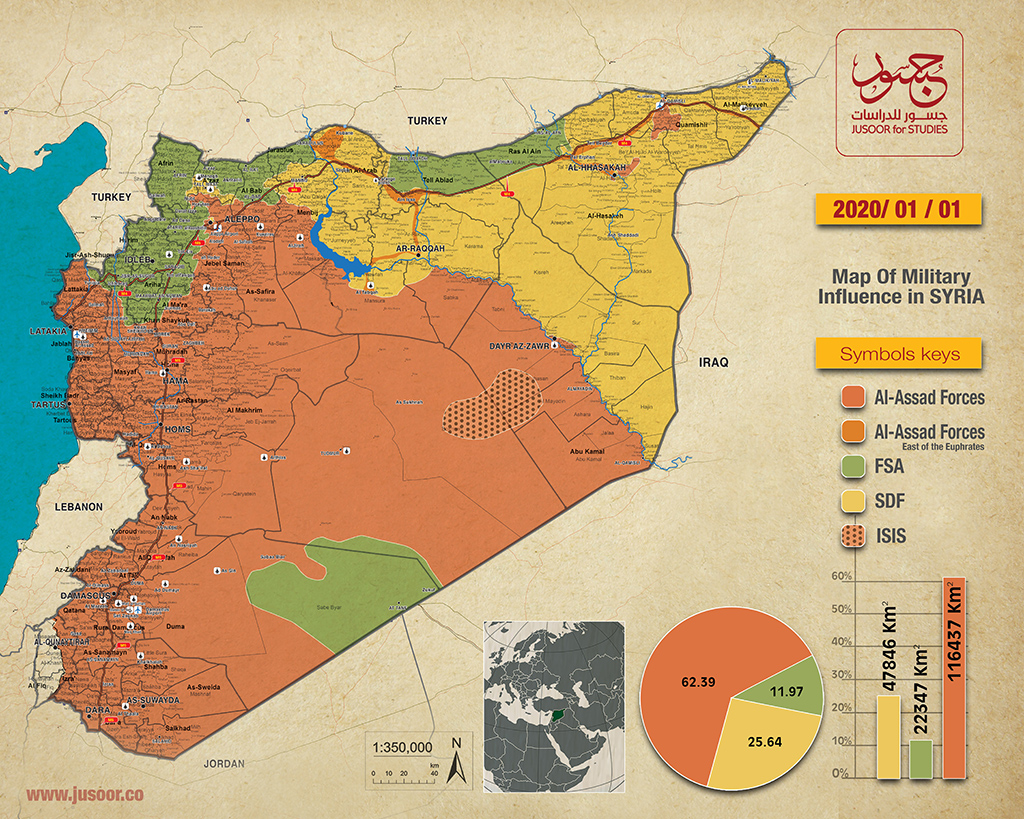
Map of military influence in Syria 01-01-2020
The map of military influence in Syria for December 2019 showed a new change in the total control ratios between the conflicting forces on the Syrian soil, compared to the ratios recorded last November.
According to Jusoor for Studies released map, the ratios of the different forces’ control on the ground have become as follows:
The Syrian opposition factions control ratio decreased to (11.97%) compared to (12.13%) recorded last month, with an area equivalent to 22,347 km2 of the total area in Syria.
The Syrian Democratic Forces (SDF) maintained the control ratio recorded last month at (25.64%). That is, an area equivalent to 47,846 km2 of the total area in Syria.
Syrian regime forces’ control ratio increased slightly by (62.39%) compared to 62.23% last month. That is, an area equivalent to 116,437 km2 of the total area in Syria.
Naturally, ISIS has not had any military control over the Syrian soil since last February.
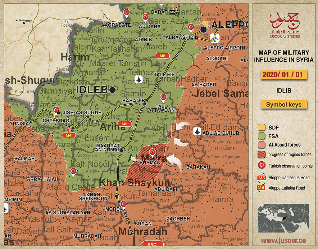
During December 2019, the Syrian regime forces made significant progress in the de-escalation zone after resuming hostilities in November 2019, southeast of Idlib. This has led to a clear change in the map of influence within the buffer zone, where the Turkish control point in Tal al-Surman became completely surrounded with the the Syrian regime forces approaching the strategic city of Maaret al-Numan.
In the east of the Euphrates, the military operations within Spring of Peace area have relatively stopped during December 2019 for the first time since the announcement of the operation’s suspension on October 23, 2019, according to the Sochi Memorandum (2019) between Turkey and Russia.