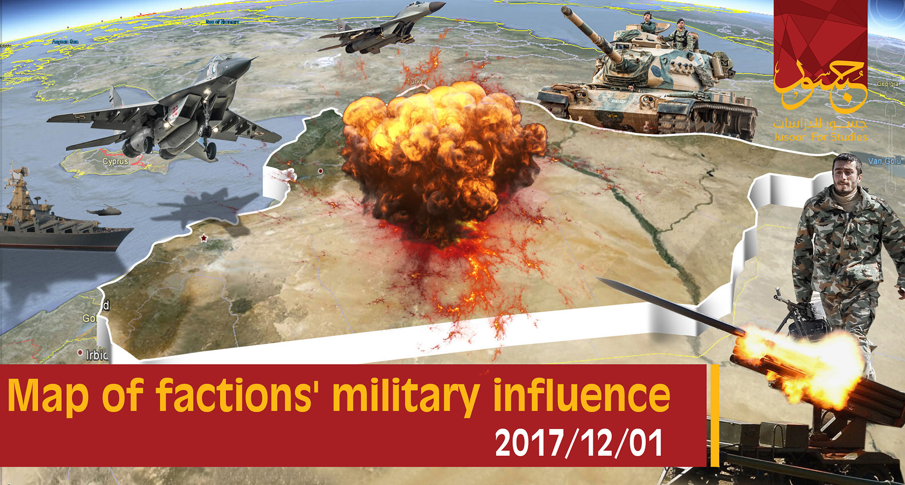
Map of military influence in Syria 01-12-2017
Font Size
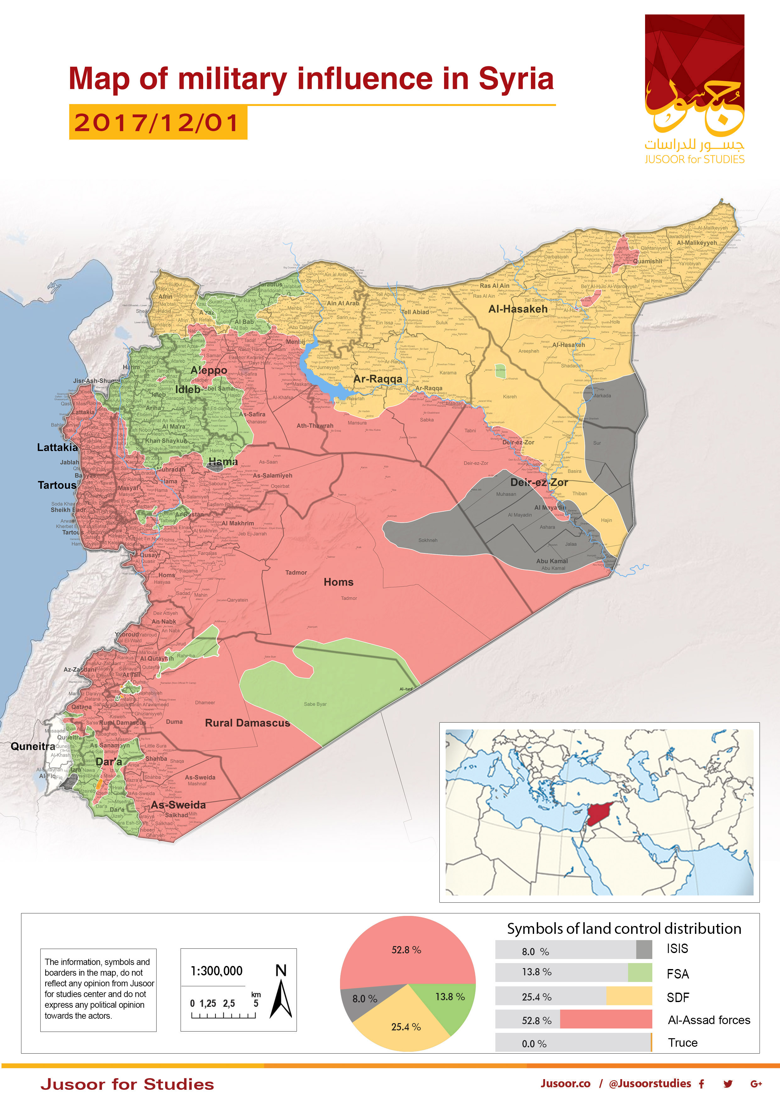
Jusoor for Studies Center issued the map of military influence in Syria for the second half of October 2017, as it shows a constant change in the total military influence percentage between the different forces. There is a notable increase in the total influence of Assad forces and Syria Democratic Forces (SDF) on the account of ISIS, while the Free Syrian Army (FSA) has maintained the same percentage as follows:
• A shrinkage in the percentage of ISIS-controled areas on the account of Assad’s forces and SDF, while ISIS controls 8.0% of areas which means 2.1% decrease.
• Assad’s forces controls 52.8 % which means 1.4% increase comparing to the last month.
• SDF controls 25.4% of areas which means 0.8 % increase comparing to last month.
• FSA kept the same percentage since mid of October 2017, which is 13.8%.
The de-escalation zones still witness violations especially north of Syria, where Assad’s forces try to advance from many axes in Aleppo southern countryside and Hama northern countryside in addition to violations in Eastern Al Ghouta. There are some changes in the controlled areas by the two sides but, it does not affect the total control percentage.
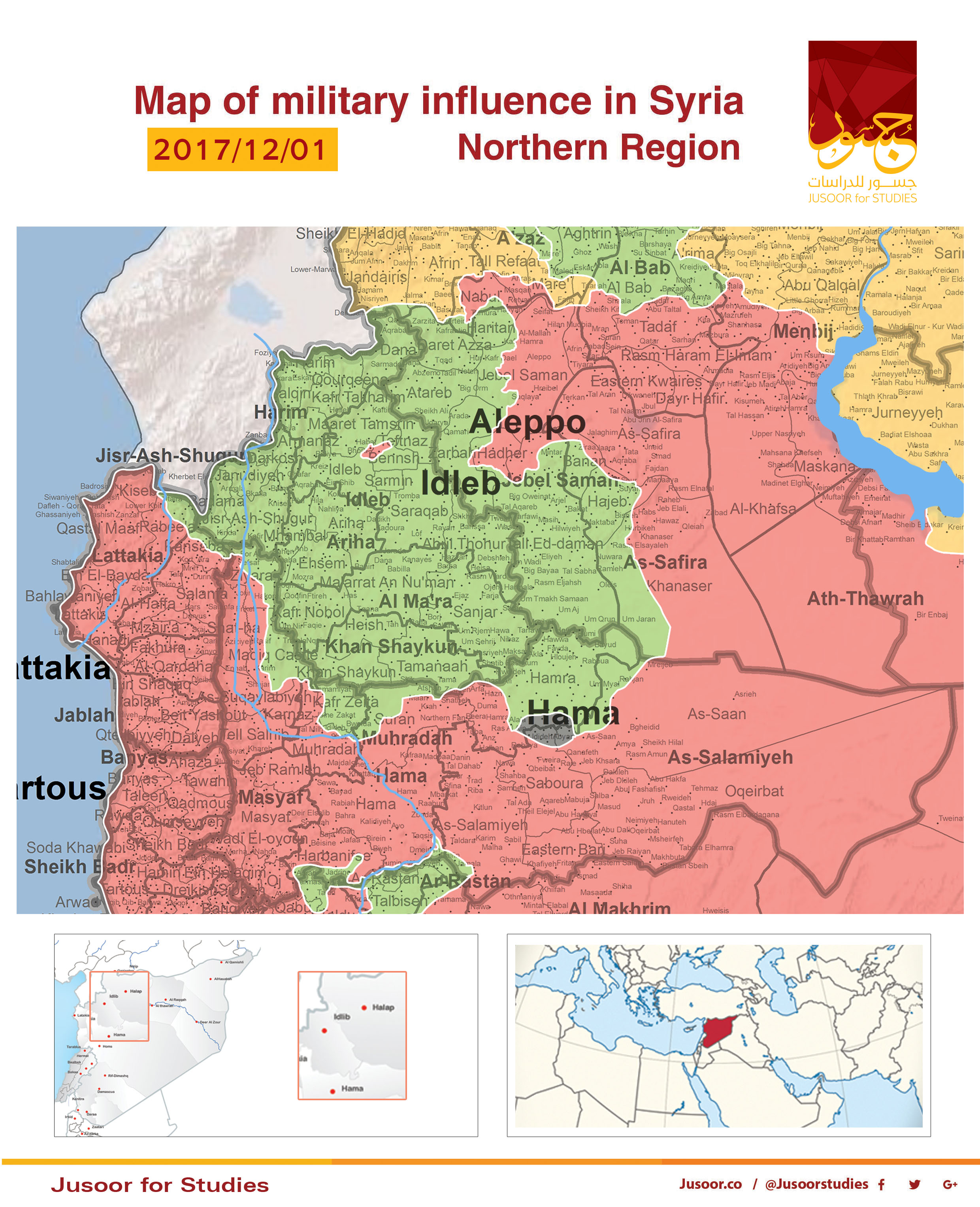
The Northern Region:
The map shows a slight change in this region but the total control percentage remains the same.
Assad’s forces continue their military operations in Aleppo southern countryside and Hama eastern countryside as an attempt to progress towards the area east of Al Hijaz Railway. Many villages and towns have changed hands last month. However, Assad’s forces were able to advance in many points on the account of the Syrian opposition’s factions.
On November 11, 2017, HTS targeted a Russian military column with a car bomb near Jableh city which caused the destruction of many armors and vehicles.
AS for ISIS, it was able to take over 10 small villages (3 of them were FSA-controlled mid of November) in Hama eastern countryside on November 25, 2017.
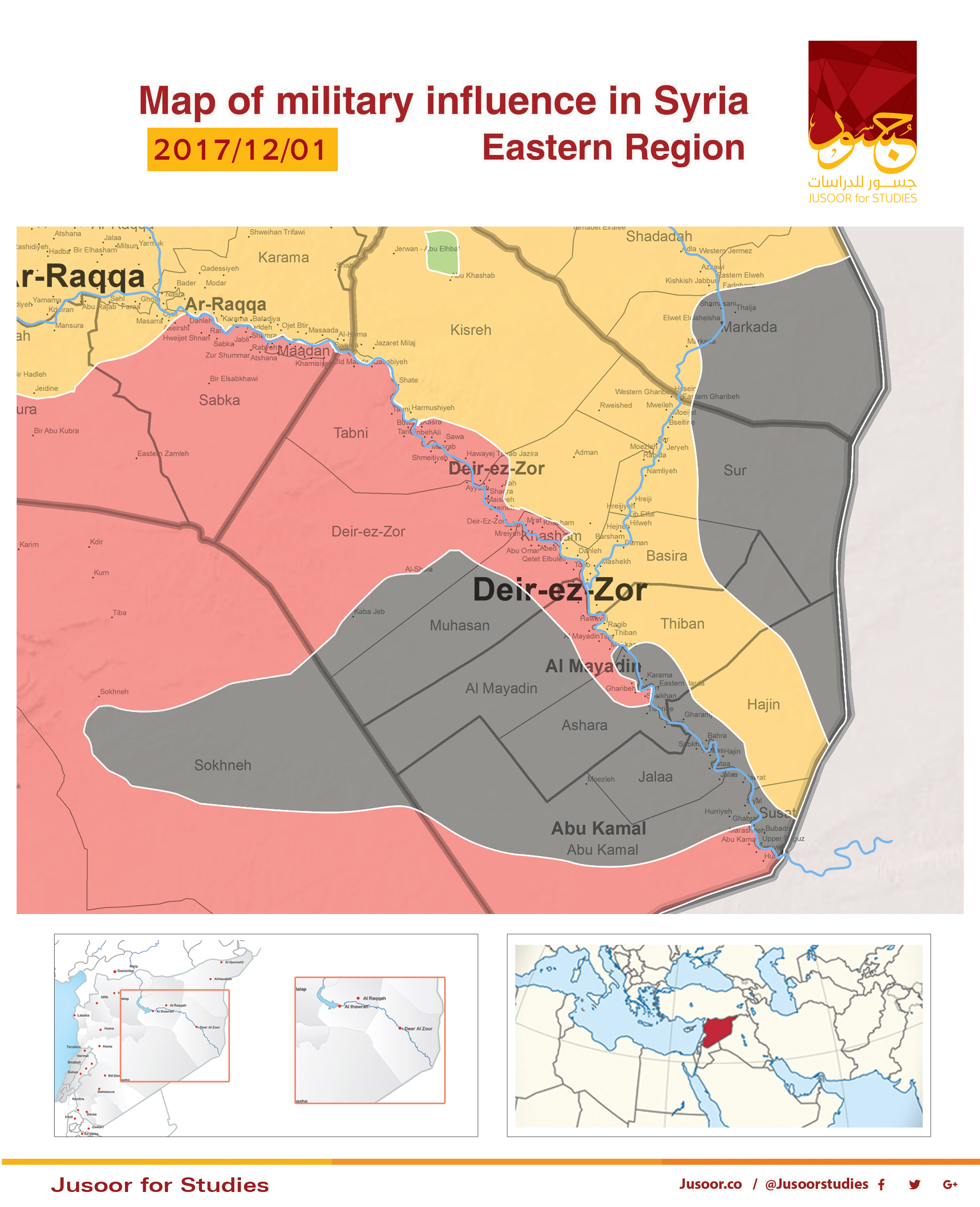
The Eastern Region:
The map shows and increase change in the controlled locations between the different forces comparing to last month.
Assad’s forces were able to seize Al Bukamal city on November 18, 2017, in addition to making progress towards Mayadin outskirt and recapturing Al Quriyah town. Furthermore, Assad’s forces controlled Al Ashara town on the left bank of Euphrates River east of Deir ez-Zor.
On November 3, 2017, Assad’s forces were able to fully control Deir ez-Zor city.
On the other hand, SDF took over many villages north Euphrates River near Iraqi-Syrian borders such as Al Basirah and Al Shehil on the account of ISIS.
The military attacks by Assad’s forces and SDF made ISIS military influence declines in the main cities thus, it controls two pockets in Al Badia, one of them south Euphrates River between Homs and Deir ez-Zor while the other one is north Euphrates River in Deir ez-Zor.
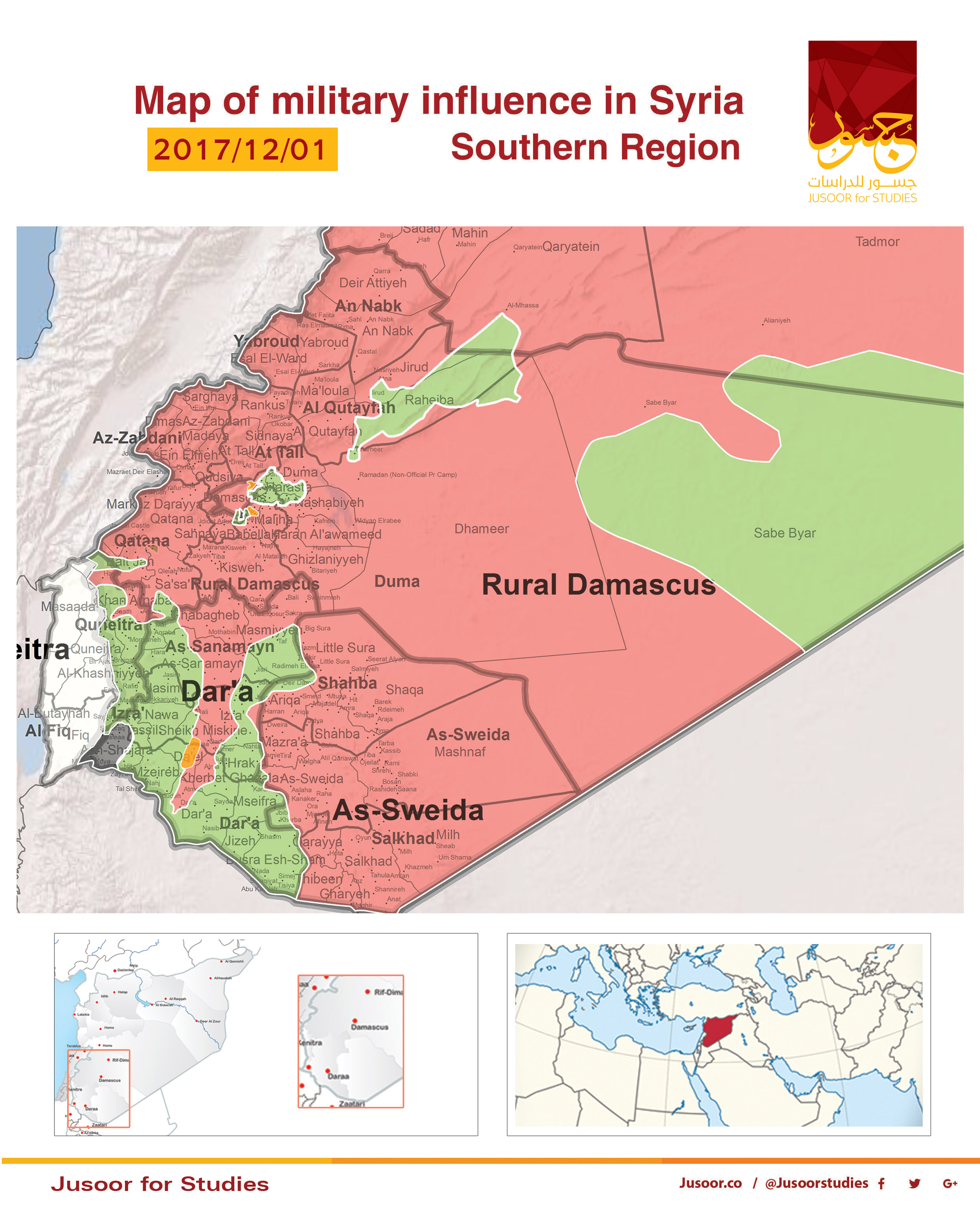
The Southern Region:
The map shows that the total control percentage has remained the same despite the successive offensives and violating the ceasefire by different forces.
On November 3, 2017, FSA factions were able to break the siege on Beit Al-Jin and the farms around this area in Western Al Ghouta. However, Assad’s forces recaptured these points after a while and the siege started again.
Mid of November 2017, FSA factions made an extensive progress within Vehicle Management Department in Harasta at the expense of Assad’s forces and kept this advancement.
Assad’s forces’ attempts to advance in Jobar and Ain Tarma have also failed.