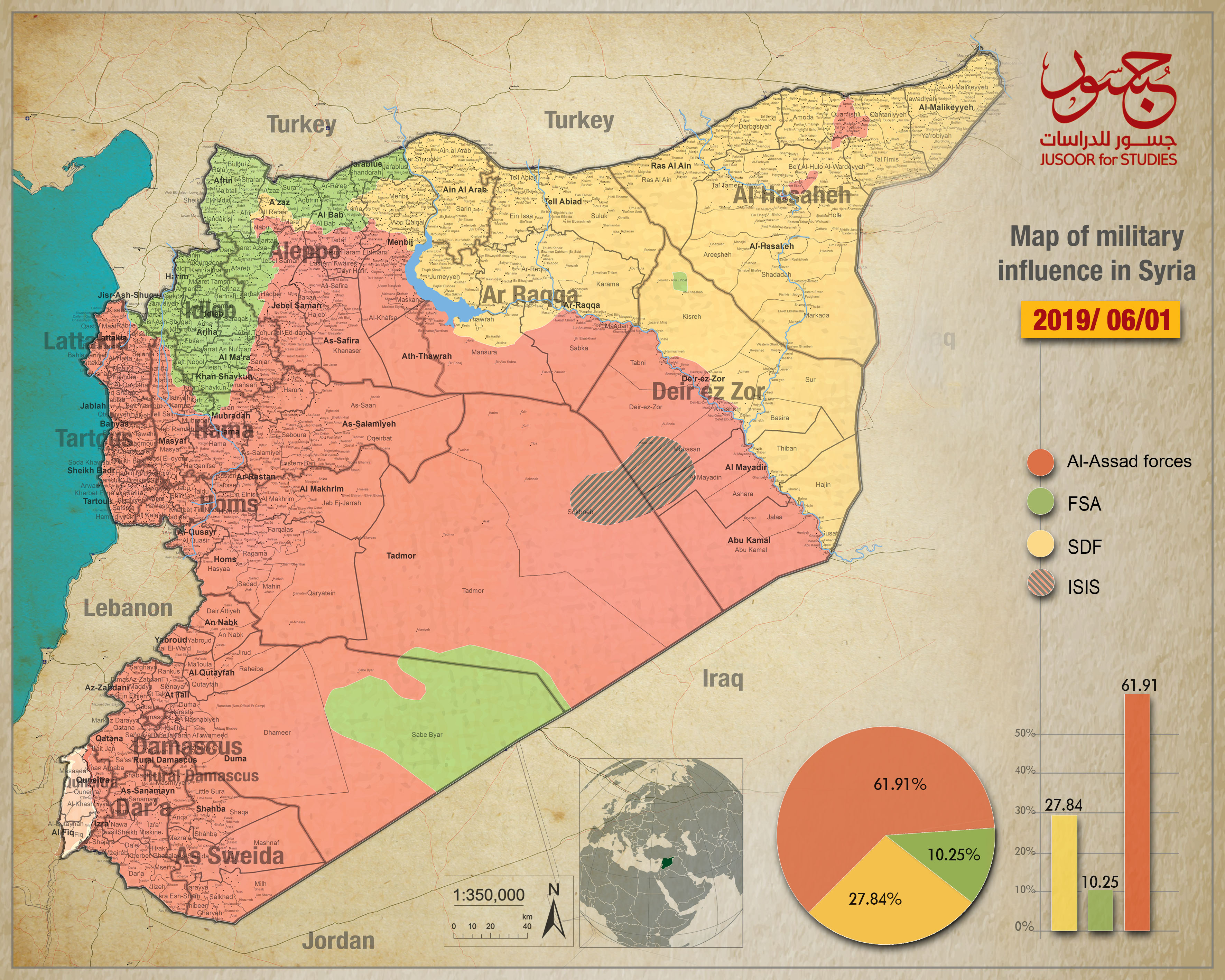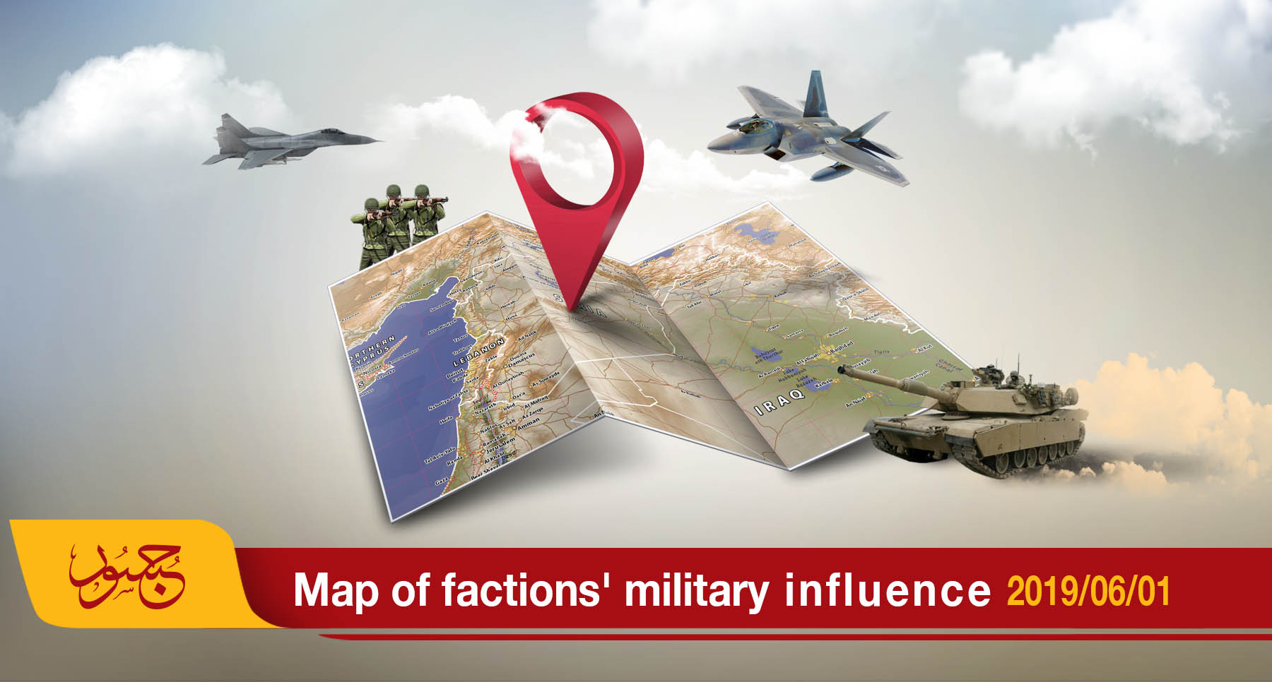
Map of military influence in Syria 01-06-2019
The map of military influence in Syria for May 2019 showed a slight difference in the total control ratios among the various conflicting forces compared with the ratios recorded in April.
This month, the Syrian regime and allied militias launched an extensive offensive on the de-escalation are of Idlib Province and its vicinity, backed up by Russian air force and coverage.
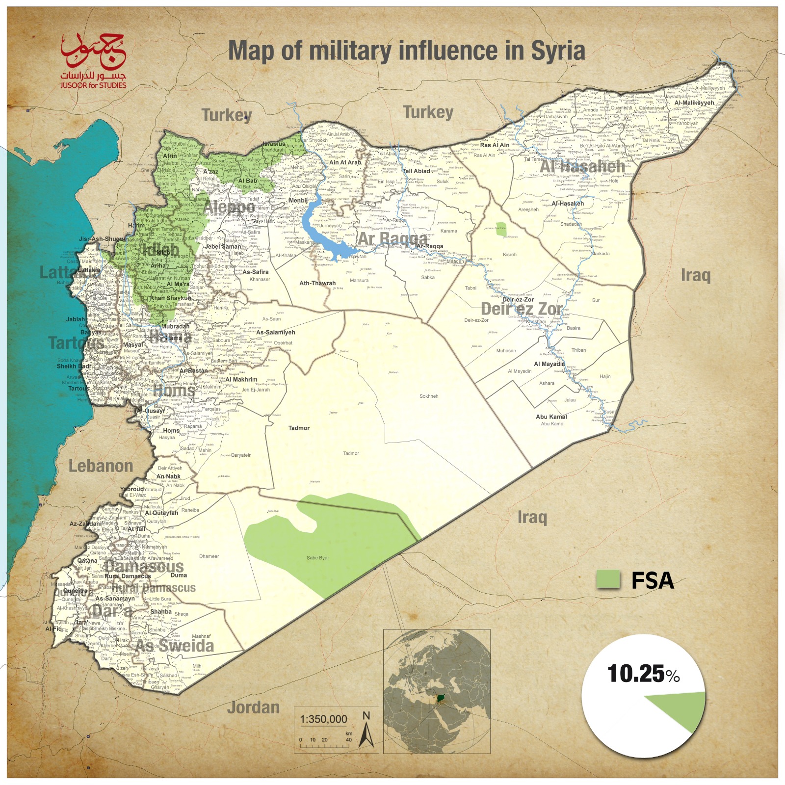
According to Jusoor for Studies monthly released map, the Syrian regime’s control ratio became (61.91%) compared to (61.88%) recorded last month. This slight increase came in part at the expense of the opposition factions, which now control (10.25%) of the Syrian land, compared to (10.30%) ratio recorded since August 2018.
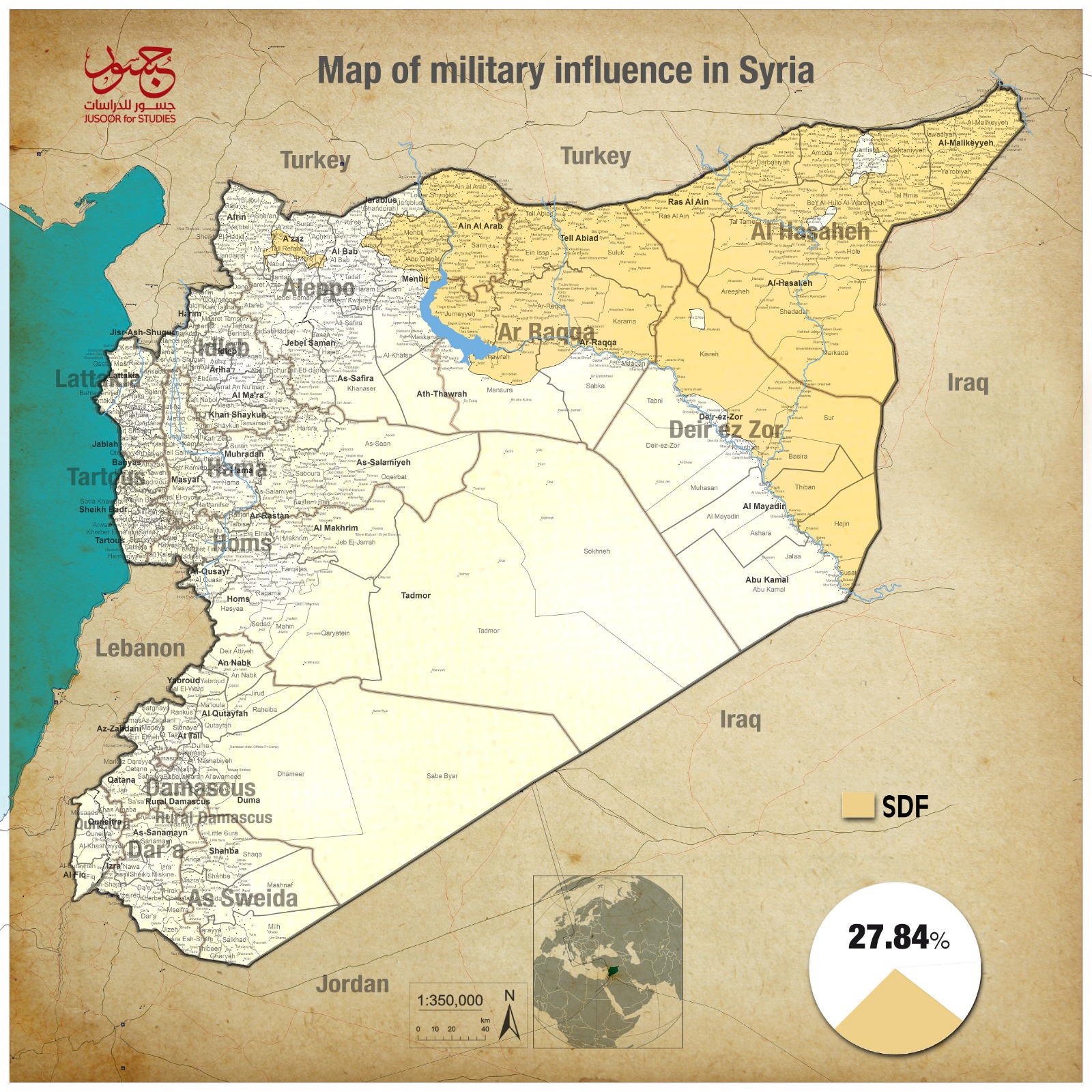
The Syrian democratic forces (SDF) control ratio has slightly decreased to (27.84%) compared with (27.92%) recorded since January 2019.
ISIS has not had any military control since February.
The Syrian North
The map of military influence in northern Syria saw a slight change in the control ratios due to the ongoing military campaign launched by the Syrian regime with intensive Russian air support on May 6, 2019. The Syrian regime and Russia have attacked by heavy fire for several weeks before launching their campaign.
On May 11, the Syrian regime controlled area in the buffer zone within the de-escalation area in Idlib and its vicinity has become 69 km 2. The Syrian regime captured cities and strategic locations such as Kafr Nabuda, al-Madiq Citadel and Tal al-Hawash. This captured area increased on May 15 following regime advance to al-Hawiz town in al-Ghab Plain to become 77 km 2. Nearly a week later, the opposition factions launched an opposite attack on Syrian regime locations in Kafr Nabuda and Tal al-Hawash; thereby, decreasing the regime’s control area to 57 km 2. However, opposition factions withdrew quickly from these areas due to intense shelling of the air force and artillery. Hence, the Syrian regime control area what it was at 77 km 2.
The Syrian East
The map of influence and control east of the Euphrates slightly changed due to the Syrian regime forces unexpected step April 29, 2019. The Syrian regime forces launched a surprise attack from their locations in the south-western village of Raqqa to control Hawat al-Jariyat village and they advanced to an estimated area of 3km. Hawat al-Jariyat is located at a point of contact with (SDF) forces. The International Coalition quickly intervened to launch air strikes against Syrian regime forces, which prevented the latter from continuing their surprise attack.