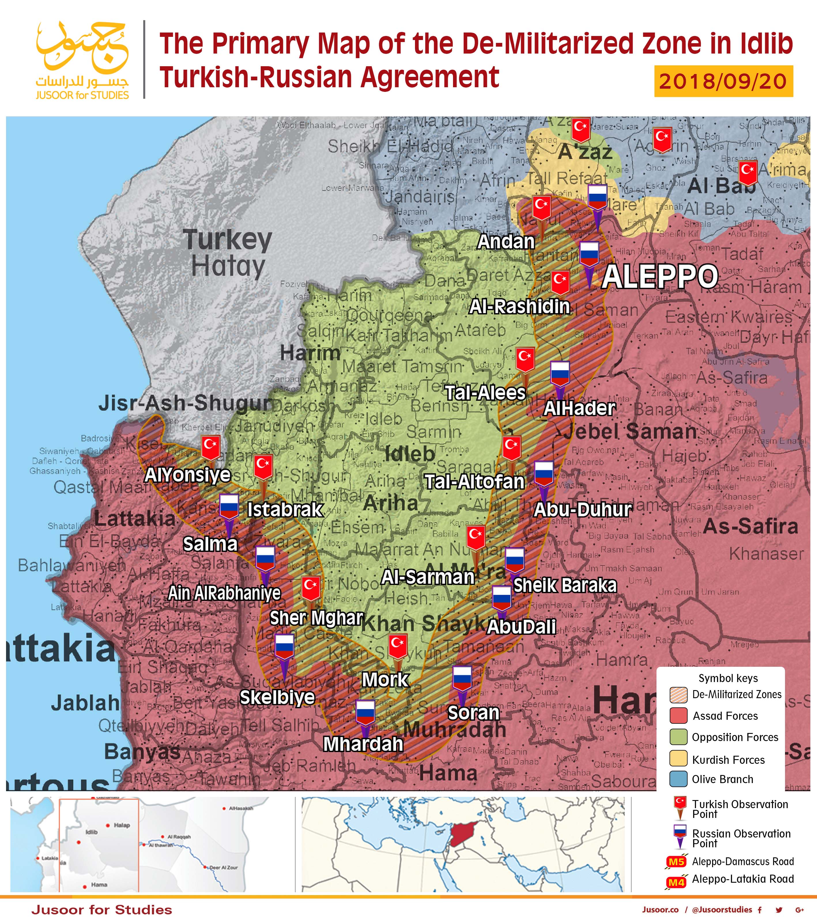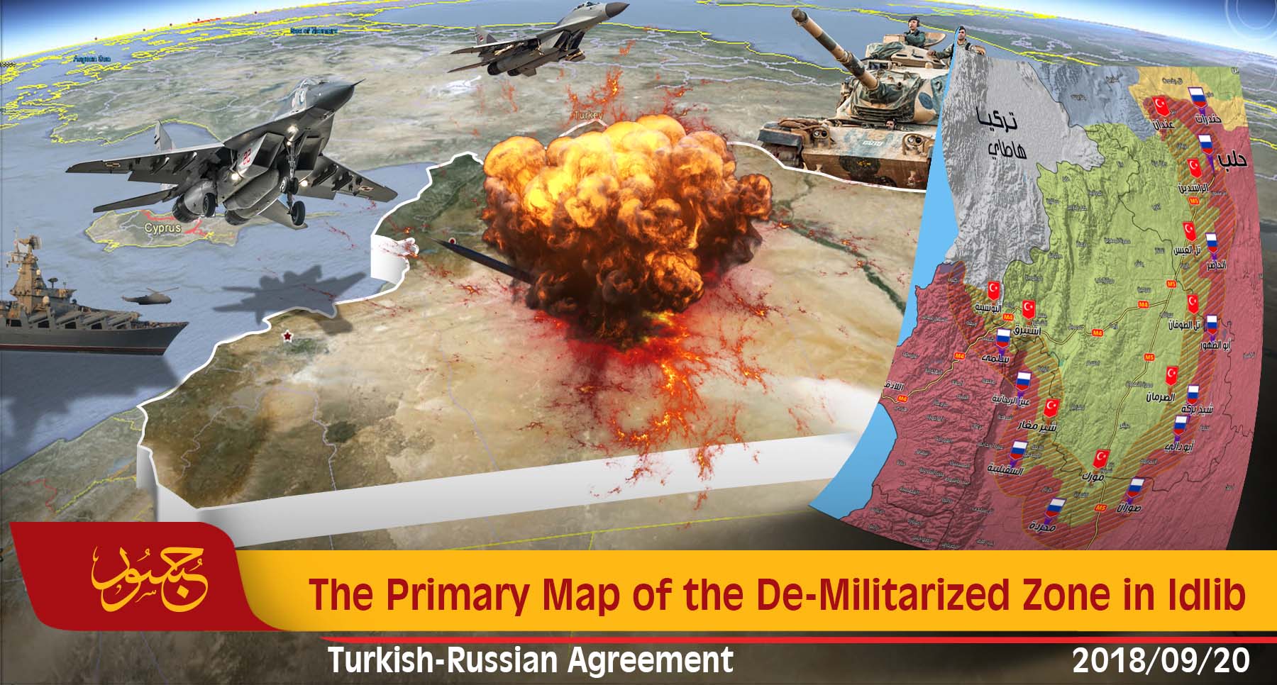
The Primary Map of the De-Militarized Zone in Idlib
The map issued by Jusoor for Studies center explains the potential shape of the de-mitilarized zone which has been agreed upon in the Sochi agreement on 17th of September between president Erdoğan and president Putin.
Drawing the boarders of the de-militarized zone will handled by a technical committee of both countries, the agreement says, thus, the depth and distribution of the will not be clear until the committee finishes its work. The map issued by the Jusoor Center provides a primary estimation for this zone as an advanced step before the formal announcement of both sides about the real boarders.
Jusoor center estimates the total de-militarized zone to be 3800 sq/m, 1900 sq/m is in the opposition-held area. The total distance of the area is estimated to be 240 km.
The shaded area between Turkish and Russian observation points represents the expected demilitarized zone with a depth of 15-20 km, all of the heavy arms should be pulled out from the opposition and regime-held areas. This depth includes vital areas - plenty of these areas are from Aleppo city and towns like Nubbul, Zahraa, Kasab, Salma and other towns.
If the articles of the agreement are applied, the forth de-escalation zone will turn into a temporary stability zone and after that into a complete seize fire zone, and accordingly there will be mechanisms to activate the international roads Aleppo-Damascus (M-5) and Aleppo-Latakia (M-4), and Turkey will enhance its observation point and start a joint patrols with Russia in the de-militarized zone.